Morocco's Water Resilience: Earthquake Recovery through Infrastructure and International Law

On September 8, 2023, a devastating earthquake struck Morocco, with its epicenter in the High Atlas Mountains, profoundly impacting the provinces of Al Haouz, Taroudant, Chichaoua, Marrakech, Ouarzazate, and Azilal, resulting in the tragic loss of 2,960 lives. The immediate aftermath saw extensive relief efforts, underscoring the urgent need for a robust strategy for disaster recovery.
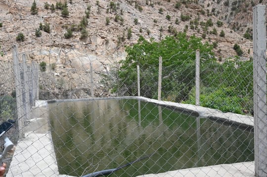
Morocco's existing water infrastructure is extensive. The country has a significant network of dams, comprising 13 water transfer systems that connect watersheds, as well as a total of 140 large dams and 150 small to medium-sized dams built between 1950 and 2015. These structures are vital for irrigation, which accounts for a substantial portion of water use, relying on large dams (47% in 2009), small dams (23%), and private irrigation (30%). However, dam capacity is continuously lost to siltation, the process of water blockage due to sand or soil, at a rate of 70 million cubic meters per year (MCM/yr).
While there are pending initiatives to build 38 new dams by 2030 and renovate upstream areas to reduce erosion, earthquakes pose a direct threat to the structural integrity of these critical assets. Beyond modern infrastructure, traditional systems like khettaras (underground canals) also play a crucial role in water collection and distribution, especially in remote, mountainous areas, embodying traditional ecological knowledge (TEK). However, the fixed, gravity-fed nature of khettaras makes them less adaptable to fluctuating water availability or changes in agricultural needs. Recovering from an earthquake in such regions must involve sustainable rebuilding that respects and harnesses this established knowledge and integrates this invaluable, yet inherently vulnerable TEK.
The United Nations Development Programme (UNDP) Guidance Note on Disaster Recovery advocates for a "Build Back Better" approach for nations facing natural disasters. The UNDP highlights how disasters, such as the earthquake that struck Nepal in the spring of 2015, offer a pragmatic approach: utilizing GIS, a tool that connects data to a map, allowing users to visualize, analyze, and understand the relationships between different types of information based on their locations.
GIS analyses and Earth observation data can assess damage, map population distribution for water demand estimation, and analyze accessibility for rehabilitation efforts. For Morocco's mountainous terrain, where access has been challenging since the earthquake, such technologies are essential for efficient and effective water infrastructure recovery. GIS allows for a more data-driven, systematic, and proactive response than ground-based assessments. High-resolution elevation data can guide the optimal placement and design of new water supply systems, ensuring sustainable long-term solutions.
Morocco’s current disaster governance framework, described as a Whole-of-Government (WoG) approach, was formed during the 2023 response. While this model facilitated some coordination between civil and political actors, gaps in local preparedness, civil society integration, and information management became apparent, slowing relief efforts. A more resilient response to future disasters will require a restructuring of how water infrastructure recovery is managed at the institutional level.
Centralization does not necessarily have to conflict with decentralization. Integrating local actors into decision-making processes—especially those with traditional knowledge of water systems—can enhance legitimacy and lead to more context-sensitive solutions. For example, the National Irrigation Administration in the Philippines supported a two-tier structure, with service associations at the base level and irrigation associations encompassing them at the project level.
One proposal is the establishment of a National Emergency Water Recovery Agency, embedded within a broader emergency management structure. This agency could develop standardized damage assessment protocols, coordinate logistics between ministries and local governments, and ensure transparent distribution of reconstruction resources. By balancing centralized oversight with decentralized responsiveness, Morocco can create a more agile and cohesive recovery system.
Another key legal principle needed in recovery is participatory cooperation, which in international law mandates data sharing, joint planning, and mutual support among watercourse states. Morocco can internalize this concept by fostering transparent, participatory governance in the water sector. Data on aquifer levels, infrastructure damage, and water quality can be made publicly available and accessible to researchers, civil society organizations, and affected communities. Utilizing data from public Moroccan Universities such as Mohammed V University in Rabat, Hassan II University in Casablanca, and Cadi Ayyad University in Marrakech can enhance GIS usage by identifying areas most vulnerable to future seismic events and inform resilient infrastructure design using open-source research for participatory development.
Morocco's path to post-earthquake recovery, particularly concerning water infrastructure, demands a multi-faceted approach. It must leverage advanced remote sensing such as GIS and TEK technologies for rapid assessment and strategic planning. Morocco can draw valuable lessons from international water law principles to strengthen its overall water governance and security, building a more resilient future against challenges posed by both climate and seismic activity. This comprehensive strategy will not only help Morocco recover from the current devastation but also fortify its water future for generations to come.
Maria Kyriacou, Student at the University of Virginia, Intern at the High Atlas Foundation In Marrakesh, Morocco.